So I tried something new…

I ran an operating session solely with people who know little to nothing about trains.

Believe it or not, I’m planning to do it again, but first, why it all fell apart!

Here’s the premise – make up a guide that covers everything to do with my operation, have people read it over, and all will be well. Was it? Well…considering said guide was 11 pages long, I don’t think people remembered it.

This was to be a trial run with time table and train orders with new train order panels I put in (more on that in another post), but a dispatcher needs to be knowledgeable about the operation, so that job fell to me.

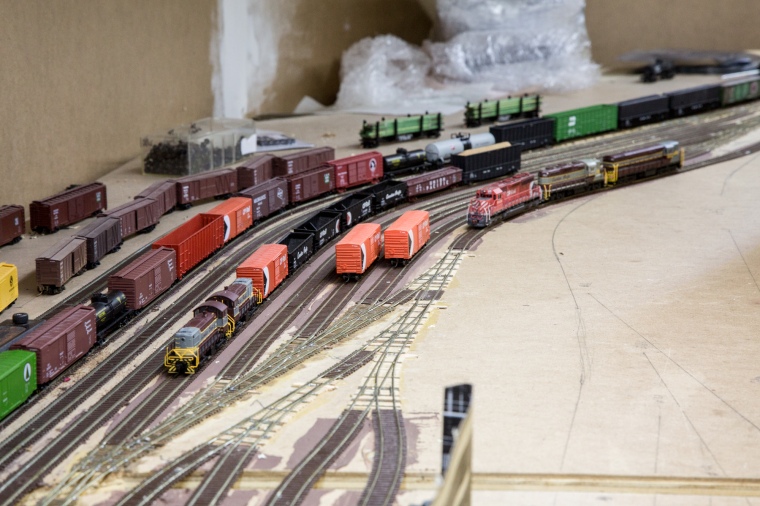
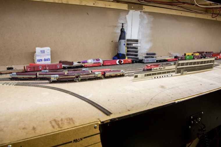
I had also wanted to work the yard, since this would be the first proper op session it would be in operation. The yard is the centre of the railway, and if it gets behind, all the trains do, as well. So I could do both, I set up the dispatcher’s paperwork and phone in the yard.

20161228-4

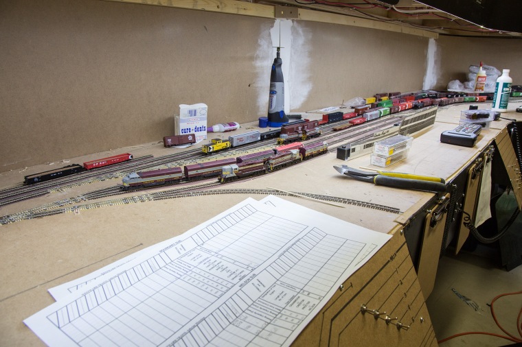
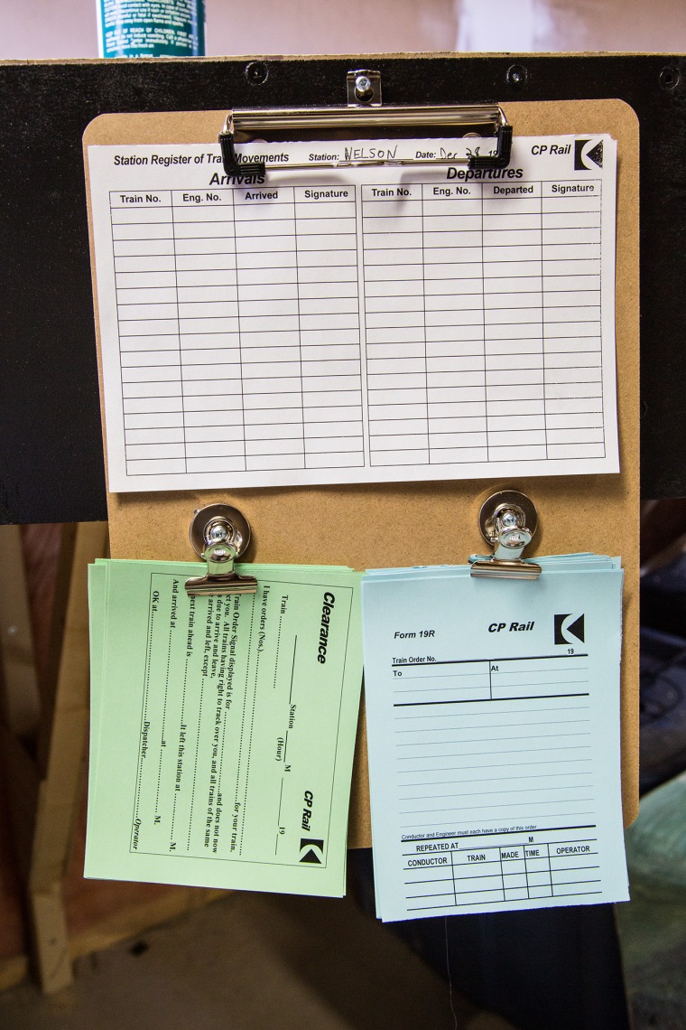
I set up new clipboards that I added extra clips to at the terminals to hold a register, clearances, and train orders. Nobody signed these. I think everyone was in a hurry! I’m also in the midst of converting my train orders to look 1970s-ish. I have the wrong form here, but I was in a hurry.

20161228-2

I had 6 persons operating. This occupied roughly 138% of my time, trying to help them and troubleshoot.

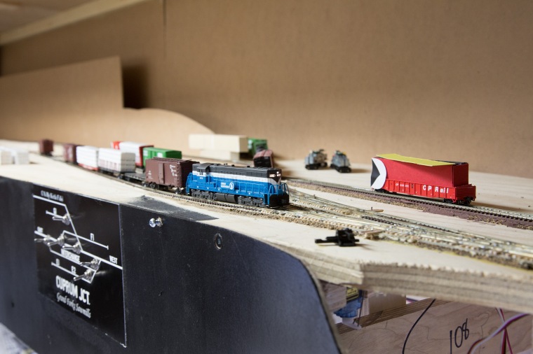
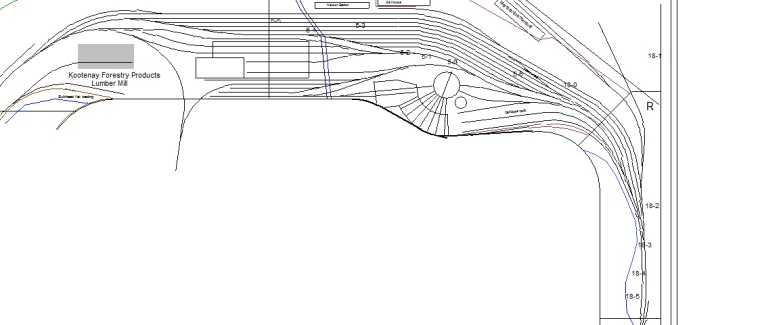
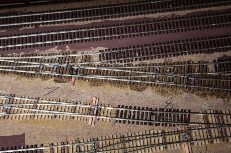
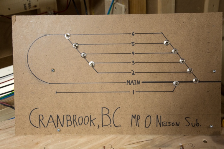
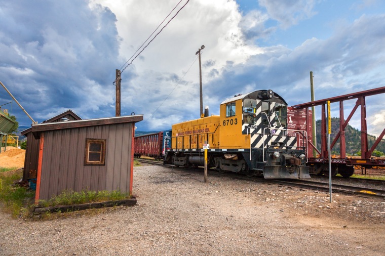
So, those were the main difficulties…then more went wrong. I had installed new switch panels around the top deck to match the fascia that I recently painted. Surprise, nearly all the switches on the Grand Forks panel were shorting out, and a major switch Grand Forks Sawmills was dead. Further to that, the switch list I had generated in JMRI was incorrect – cars were listed to be picked up that already had been. Definitely my fault, but when? This is when I told the operator of the GN Grand Forks turn to park in the runaround and get another train.

20161228-3

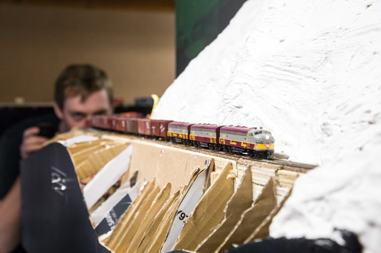
I set him up on a worry-free through freight and turned my attention to Grand Forks. In the name of fun, I frantically ripped out the DCC feeders to the toggle switches that route power to the frogs. It didn’t work. Everyone had questions. The session was crumbling around me. One person felt tired and that couple left. Stress was winning. The worry-free freight train was stalling on the hill and derailing often. My manifests were confusing. Grand Forks was still shorting out.

Somehow, everyone but me was still having fun.

20161228-1

The 4:1 fast clock was started at 0530, with the first train running at 0550. We were markedly behind, and I stopped it at 0840. By 3 hours in, we made it to about 1030 – not too shabby considering how hectic and broken everything was. I would have hoped to make it to 1730 by that point, but a shade under half wasn’t that bad, considering.

So, what went wrong?

I’m going to have more sessions with non-train-people. However, I think these things are important:

  1. You need to have no technical issues.

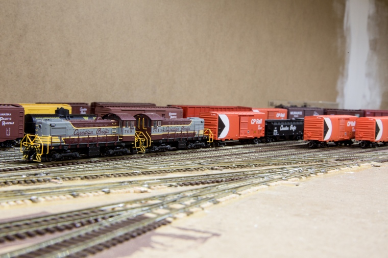
Derailments were caused by new cars that had wheelsets with huge flanges and low hanging trip pins. Easy to eliminate, and everything should be tested before it’s given to someone. The yard crew worked very well, except for a couple of underweight cars with truck mounted couplers that derailed often when shoving long cuts

2. You need to be available to help people.

Trying to keep a railway running smoothly made it feel as if I was leaving people in the lurch, and if I was responsive to issues, I saw all trains grind to a halt. Don’t take on too many jobs.

3. Keep the numbers low.

I felt like 4 was a manageable number. That’s half of what I might expect for a full op session with train people. Everyone will need more help, and you don’t want to be overwhelmed. (See #2)

So, I’ll let you know how the next session goes!

Epilogue: Troubleshooting Grand Forks

Finding the incorrect wheelsets and wires that had come off toggles in the sawmill was the easy part. Grand Forks caused considerable consternation. The frogs are powered, which means that when the toggle is thrown, DCC power is routed through it. The same toggles also actuate the servos through Octopus III controllers. So, with my system set to be 13V across the rails, one should see 13V from one rail to the frog, and 0V from the other to the frog. What I ended up seeing was 14.5V from one rail to the frog, and 0V for the other – even though track power was only 13V, and the DC power supplies for the Octopuses were turned off! There was, in fact, a wire soldered incorrectly. The B rail of the DCC system was connected to the common wire to the Octopus’s control inputs, and somehow that transformed it up to 14.5V at the frog. Only took me 5 hours to fix all the above issues! The layout should be good to go now…

Nelson, BC yard and Cranbrook staging build

Well, it’s been a very busy summer for me! I got a lot done immediately after the first operating session in April. That showed me that my idea of building the layout in stages didn’t particularly work with my vision, and Nelson as a staging yard became a very confusing place. So, I removed the temporary staging tracks, and built the yard.

The Yard: Prototype Nelson includes the mainline, 3 long tracks, and 5 short tracks in the yard. I ended up with 4 long tracks in the 1500-1900′ range, and 4 short tracks in the 500-1100′ range. As on the prototype, there are 2 curves to the north within the yard. My plan includes a RIP yard, wye, and roundhouse that I have yet to install, but are marked out. Here’s an overview:

20161219-4 nelsonyard

If you think the yard seems empty, you’re right – I took most of the cars out to body mount the couplers and weight them closer to NMRA spec.

I built the yard ladder with the turnout points nearly butting into the frogs to allow for the longest possible tracks with a #6 ladder.

20161219-8

After installing that, I realized that the engines for all these trains that terminate and originate at Nelson need to go somewhere, so I sucked it up and built the run-through portion of the shops!

20161219-7

The Operations: I’ve decided the 4 long tracks are arrival/departure tracks, and worked hard to make them run fluidly with JMRI. Track 1 has setouts from all Nelson sub freights as well as the east Boundary freight (for chip gons from Grand Forks and Midway) and pickups by the Kraft Switcher, train 87, only – This allows that track to be the one on which the Kraft is built. Similarly, train 81, the westbound Boundary freight is built on 2, and the Nelson freights are built on 3 and 4. (This is subject to change. I’m thinking of using 4, which is only useful for 1100′, as a build track for an extra train to Trail to get pressure off the Hotshot)

The yard tracks, 5-8, are used for all trains. There’s one little tweak within them, which might be eliminated with the previously mentioned change. The smelter at Trail takes in lime cars from the tipple at Fife, and since the hotshot isn’t built at Nelson, the east Boundary freight drops these cars off specifically in track 5. Track 5 is split into two tracks within JMRI, 5, and 5-5. These are pooled, and 5-5 can only be worked by the east and west Boundary freights and the east and west hotshot. This allows the lime cars to stay together without a kernal, so only one move needs to be made. Calling it 5-5 makes them both show up as the same track, so without explanation, you’d simply think it’s running very nicely!

The yard is run with a pair of MLW switchers from the east end. Currently I’m having fun with the sound-equipped Atlas S2s. (Note: The layout is always viewed from the north, so east is left, west is right)

20161219-5

There is an industrial area behind and west of the station, and when that is built I may need to add a second yard job with a single unit at the west end. My idea is to have the Nelson crew also be responsible for hostling power and getting crews and trains together – this means it will probably be a 2 person job, regardless of whether 1 or 2 sets are in use.

As for the shops, they work like this: Any incoming train, save for the Hotshot and passenger trains, will pull into its assigned arrival/departure track. The power will be cut off and run to the west end of the shops – this is where the near track that runs around the north side of the yard comes in. The engines are run into the shop and then, when the next set of power leaves ahead of them, they’re moved forward to sand/fuel pad. Each of the two shop tracks, including the fuel area, accommodates 2 4-unit consists. Once they’re ready to go, they may be taking a westbound train – I didn’t want them to have to run down the main to get to the west end of the yard, so they’ll take the runaround track all the way to the west ladder. This is prototypical.

On to Cranbrook!

The Yard:

Prototype Cranbrook is a division point where trains arrive and depart, in effect, in 5 directions – East, the Crowsnest subdivision to southern Alberta, west, the Nelson subdivision to the Kootenays, north, the Windermere sub to Golden, northwest, the Kimberley sub to the Sullivan mine at Kimberley, and southwest, the Kingsgate sub to the UP line in Idaho. Note that none of these junctions are near Cranbrook save for North Star junction to Kimberley. My modeling picks up after Curzon Junction, so we don’t see any of the Kingsgate traffic. However, most of the tonnage on the Kootenay Division moves east from Nelson through Cranbrook to points beyond. It’s a staging yard, so I kept things simple. 5 ~2000′ tracks are containing within a staging loop, and one 1200′ track sits outside of the loop. This is nearly identical to Midway. I have potential for more levels of storage between Cranbrook and Midway, but I don’t want to add them until I feel it’s necessary. The layout is shown on this masterfully drawn temporary panel.

20161219-11

I try to keep run-through freights balanced between Cranbrook and Midway, that way operators who aren’t into switching have something to do.

I’ve decided to not lay the industries on the Nelson subdivision at this point. This includes a lot of spots at Creston, a log reload at Tye, and the Kootenay Lake barge operation at Procter. I’ve built enough for now, and it’s time to see how it works!

20161219-10

All turnouts in both yards above are controlled with Tam Valley Octopus controllers and 9g micro servos.

PS – It’s not quite cleaned up at the moment. There’s still lots to do before the next op session!

The Columbia and Western Railway: Cycling the C&W in 2012

I suppose this post is a little late. In August of 2012, a year after I started building my railway, my bicycling beauty Adrienne and I biked from Castlegar (mile 25.7 Boundary Sub.) to Grand Forks (Mile 94.8) over two hot, sunny days.

A little preface: Castlegar was founded on the west side of the Columbia river at its junction with the Kootenay. It was an important transportation centre from the beginning – steamships plied the Columbia, but couldn’t navigate up the rapids of the Kootenay to the booming silver mines around Nelson, so CP built the Columbia and Kootenay railway in 1890 from Nelson to Robson, on the east shore of the Columbia a couple miles up from Castlegar for a sternwheeler landing. A couple years later, Augustus Heinze built a smelter in Trail as well as the narrow gauge Columbia and Western railway up the valley to Rossland. It was converted to standard gauge, and extended to Robson West (2 miles up from Castlegar, across the river from Robson.)

Things are really snowballing in Boundary country at this point. Copper ore has been discovered at a number of mines in the West Kootenays (Notably Phoenix and Greenwood) and the best route is to go down the Kettle River to the GNR in Washington. We wanted to put a stop to that, so under the C&W charter CP built a bridge across the Columbia at Castlegar, turning it into Castlegar Junction, and over Farron and Eholt summits to Grand Forks and Midway.

This is that journey.

At this time, the Kraft switcher ran with a single unit (GP38AC, in this case) in daylight. Here, it’s finished its work for the day, and is parked at the old station platform.

img_4528

The station was originally inside the wye, but moved to the south side in the late 1980s to become the Castlegar museum.

img_4534

The Kootenay Express, Train #12, stops at Castlegar about 1955

The railway follows the south shore of the Columbia west from Castlegar, past Robson West, now a storage siding for the Celgar mill.

Celgar, derived from Cellulose and Castlegar, is a large paper mill, the largest employer in town. It’s big, is what I’m saying.

kvr007

Past Celgar, we get onto the railgrade. It’s abandoned past a small cement reload, as improvements to highway 3 in the 1980s took away much of the traffic, and CP was left losing a couple million a year. The line over Farron summit saw its last train in 1990.

The first siding west of Celgar was Labarthe. At the bottom of Farron hill, it hosted a turntable, and turned helpers in the steam days to assist heavy trains from Trail over the average 2.2% grade to points west. In the 1960s, CP had to reroute the railway higher as the Hugh Keenleyside dam was constructed to flood the Lower and Upper Arrow Lakes – flooding the majority of fertile land along the Columbia. The line was rerouted around the Labarthe tunnel, which is only visible when the water level is low. The level fluctuates by up to 60 feet, so sometimes the water level is low enough to reveal the ties.

kvr013a

Can you see it down the shoreline?

47img_8152

6 miles up is the first major bridge on the hill – McCormack Creek.

49mccormack-creek

Across the lake, you can get a good view of this bridge from Syringa Provincial Park. It’s very cool to see the right of way hanging on the hillside.

img_9404

Next up is Shields station, home to a logging spur, and now crossed by Shields Forestry Service Road. You can find the remains of the 33 car siding, pulled in the late 60s, and the station foundation here.

kvr038

kvr039

kvr041

A bit further up, the line hangs to the cliffs on rock retaining walls, and you get a view down to the cottages on Shields Creek below.

kvr044

Continuing up the hill, you hit two tunnels, one straight, and one curved.

kvr049 kvr057

Then two bridges, Farr creek and Bear creek.

Farr creek is a fascinating bridge. Originally a through truss over the Elbow river in Calgary, this link and pin structure was relocated and rebuilt to its present configuration sometime in the teens.

kvr080

Bear Creek bridge is identical to McCormack Creek bridge in every way – except it’s slightly more curved at each end.

kvr081

There’s one more tunnel through a small, hard nose of rock…

kvr104

And then you’re in Coykendahl. Coykendahl is located at Mile 43.5, halfway up the hill, and back when there was a west and east freight in the same day, they often met either here or at Farron.

kvr110

Coykendahl is also notable because a small red shed remains here, built into the hillside.

kvr108

Not far beyond Coykendahl, the line turns up the Pup Creek valley and away from the Lower Arrow Lake. In this last view as it rounds the corner, you can see the line snaking its way all the way back to Labarthe, now a thousand feet below.

kvr110a

Brooklyn Creek was a major trestle along this route that was filled in, but washed out in 2011. Crossing it was awful, and I have no photos.

Not too far beyond that is the Bulldog tunnel. Not quite a kilometer, it’s 912 meters long, mostly straight with a curve out the west end. Between when the line was built in 1900 and its completion in 1902, a number of switchbacks carried the railway across this ridge.

kvr111

kvr114

We’re in the homestretch now. Two sidings existed between the tunnel and the Summit – 33 car Tunnel, and 14 car Porcupine. I’m modeling Tunnel as an abandoned siding, with the foundations of a water tower…just like real life.

kvr122

Porcupine Creek was another large trestle that was filled.

kvr125

Finally, we reached the summit at Farron, 2500 vertical feet and 50km above where we began our journey.

kvr139

Farron sits in a narrow pass between Dog Creek, which drains into the Lower Arrow Lakes, and McRae Creek, which drains into Christina Lake. A diesel fuel tower still remains here.

kvr141

The home of helpers for the steam era, Farron was home to a number of buildings and a wye. We set up our tent on the tail track of the wye, which is partly used for a logging road.

kvr128 kvr129

Many building foundations remain at Farron.

kvr144

Just west of the summit, as you tip over onto the downgrade to Christina Lake, is an unusual monument – a grain bushel, dedicated to Peter Verigan, a leader of a community of Russian Doukhobor pacifists, and other 6 victims of a 1924 bombing of train 11.

kvr157 kvr160

Up next is one of my favorite little features, though I can’t explain why – this little pond draws me so.

kvr169

Paulson was a fairly important station on the C&W, having a mail drop and hook as well as a sawmill.

Today, it’s home to a detour road from the highway, and we chose to eat a can of fulfilling, cold beans there.

kvr179 kvr182

Neat culvert at Paulson.

kvr185

This is where the line really starts dropping. It follows McRae Creek down its valley, and the creek falls faster than the railway. A short distance south (railway west) of Paulson is Paulson Gap, where the creek slots between a couple noses of rock as Highway 3 soars above on a large arch bridge. There are spectacular cliffs, a tunnel, and formerly a snowshed in this curve. What more do you need?

kvr217 kvr223 kvr238

Inside the tunnel is some interesting rockwork.

kvr241

Both ends have concrete liners, however, the west portal has no overburden for the first 15 feet or so.

kvr243 kvr245

Just beyond here, the creek swings west.

kvr250

We were really hurrying at this point to make it to Grand Forks in time for dinner, so I didn’t take photos of many of the interesting features in this stretch – abandoned water towers, flumes, and a truss bridge over a slide path.

Things get amazing as you hit Christina Lake, though. The railway is high above McRae Creek, and swings south high on the mountainside.

kvr268

Looking south over the town of Christina Lake – the railway continues down on a grade that will have it reach the bottom a few hundred feet from the US border.

img_2315

At Fife, there existed a limestone tipple until it was torn down in 2016 – owned by Teck Cominco (once part of CP, and the owners of the Trail smelter) it was unsafe.

img_2305-plain

There’s also a small shed, maintained by the C&W trail society.

img_2312

Some neat rocks as we swing onto the 500 foot Kettle river bridge #5 (the first you encounter coming from the east, but they’re numbered from the west)

kvr271 kvr291

The bridge itself:

img_6307

From here, the line runs through grasslands to Grand Forks. It was just west of here that I got a slow leak in my tire – not wanting to take the time to change the tube out, I resolved to pump it up every 15-20 minutes as we hurried along the dusty, hot trail toward a delicious dinner.

The only remaining railway in this area is a mile of the Boundary sub served by the Grand Forks Railway, which runs to the border and meets up with the Kettle Falls International, running on ex-BNSF, exx-GN trackage to serve the sawmill. They run with 6703, an ex-CP SW8 that was bought from CP and left there when they pulled up rails to the east.

kvr314 kvr317

The Grand Forks station is now home to a restaurant. It was more than welcome.

img_4537 img_4535

That’s it! We continued west on the C&W and KVR on other trips, but this was our experience on the C&W that I’m modeling. I hope you enjoyed it!